| Accession Number | RC11577.1825 |
|---|---|
| Map call number | G9282.B6 s25 |
| Collection type | Published Collection |
| Record type | Item |
| Item count | 1 |
| Object type | Map |
| Maker |
2/1 Australian Army Topographical Survey Company 2nd Field Survey Company |
| Date made | February 1945 |
| Conflict |
Second World War, 1939-1945 |
| Copying Provisions | Digital format and content protected by copyright. Non-commercial use permitted. |
Arawa, Bougainville Island : 1:25,000
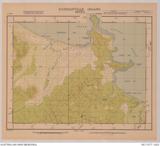
Description
A single sheet from the Bougainville Island topographical map series covering the central coastal area around the village of Arawa. Shows bays, reefs, jetty, villages (many destroyed), Tunuru Mission marked as destroyed, Arawa Plantation with reported light motor road, foot tracks, rivers and streams, wetland areas, gardens and other vegetation and terrain features. Relief shown by form lines. "ICO/020/4848". Includes, on verso, legend, index to adjoining sheets, and reliability diagram. compilation and drawing, 2 Aust Fd Svy Coy (AIF), Feb. '45 ; reproduction, 2/1 Aust Army Topo Svy Coy, Feb. '45. Referred to as: Arawa 1:25,000 series, no. 4878