| Places | |
|---|---|
| Accession Number | AWM2022.10.680 |
| Map call number | G8501 1900 |
| Collection type | Digitised Collection |
| Record type | Item |
| Item count | 1 |
| Object type | Map |
| Physical description | 2 Image/s captured |
| Maker |
Ordnance Survey Office |
| Place made | United Kingdom: England, Hampshire, Southampton |
| Date made | 1900 |
| Conflict |
South Africa, 1899-1902 (Boer War) |
| Source credit to | This item has been digitised with funding provided by Commonwealth Government. |
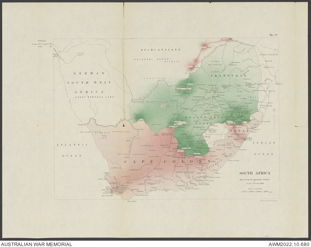
South Africa Map Showing the Approximate Situation on the 31st Dec. 1899

Description
A map titled 'South Africa; map showing the approximate situation on the 31st Dec. 1899' covers Transvaal, Orange Free State, Natal and Cape Colony, South Africa. Scale 1:5,000,000, no. 17, Ordnance Survey, Southampton. Shows roads, boundaries, rivers, and populated places. Also shows the areas held by the British and the Boer forces as of 31 December 1899, as well as the locations of military leaders from both sides.